EASY PEAKS

However, in the summer, they present little difficulty apart from needing reasonable levels of fitness. Be warned though, in summer thunderstorms commonly bubble up and bring obvious hazards.


Kasprowy Wierch
This mountain is very well known across Poland and beyond because it offers the only area of alpine skiing in the country. As a result it boasts a cable car and two chairlifts. However, it is also an easy mountain to trek up in summer conditions (don't attempt in winter unless you are experienced in winter mountaineering as there are some dodgy areas where the snow hard packs, and ice axes and crampons are needed).


Breaking trail on Kasprowy in winter


In summer though, it is perfectly accessible for all abilities. I guess the down side is that after all your effort and sweat, you arrive at the top cable car station where there are hordes of people.
To get to Kasprowy, jump on one of the numerous minibuses from outside the bus station in Zakopane to Kuznice. Take the green trail which will eventually zig-zag you to the top after a about 4 hours.
There are a variety of options to use to descend, one of them being to simply hop on the cable car!


Views to the High Tatras from Kasprowy
Giewont

The Sleeping Knight - Giewont
Giewont is the "Sleeping Knight" mountain clearly visible from Zakopane, and is notable due to its profile really resembling a man lying down. The massif is made up of Great Giewont and Long Giewont. It is Great Giewont which is higher at 1894 metres, and has a selection of marked trails ascending it. The easiest is the blue trail from Kuznice. Be warned though, the 15 metre high cross that sits atop Giewont is a place of pilgrimage, so you will have plenty of company on your slog up this peak.


Bear poo on the Giewont trail in Autumn
From Kuznice follow the blue trail which, to begin with, is a wide cobbled road. Pass the mountain hotel of Kalatówki with its lovely meadows, until you reach the Hala Kondratowa hut. You may wish to stop here for refreshments or make use of the toilet. The hut cat will likely make your acquaintance and sniff out any grub you may be carrying.


Inversion on the Przełęcz Kondracka col
From here the trail takes a sustained ascent, eventually zig-zagging its way to the Przełęcz Kondracka col. From here take a right towards the summit. Word of warning though, due to the number of visitors swarming to this point, there is a one way system marked. Also, the final ascent involves a small amount of hauling yourself upwards hanging on to chains over very polished rocks. Nothing too treacherous though.
There are two other trails which are a bit more challenging to the top of Giewont. One is the red trail from the Dolina Strążyska. This is a major slog, but once you come out of the treeline, you are rewarded nicely with lovely views and dramatic rocky formations. The other is the yellow trail accessed from the Dolina Małej Łąki. This offers great views as you approach the massif and a quieter way to reach the col. Both these routes close in snowy conditions due to avalanche danger.


Approaching Giewont from the Dolina Małej Łąki - Giewont is on the left

Czerwone Wierchy

The Dolina Małej Łąki again with Czerwone Wierchy on the right
This is one huge massif in the Western Tatra. It consists of four peaks - Ciemnak 2096m, Krzesanica 2122m, Małołączniak 2096m and Kopa kondracka 2005m all linked by a very wide, well trodden, grassy ridge. They can all very easily be accessed by following the above mentioned trail leading to Giewont, but take a left when you get to the Przełęcz Kondracka col. Although many in the mountaineering world would not consider these major mountains, you really do start to feel heavy legged with altitude when you get near the summits of these lumps.


Czerwone Wierchy
For more adventurous trekkers, a better, quieter approach is following the blue trail from the Dolina Małej Łąki, which takes you through lovely alpine environments with flowers and butterflies. Alternatively, approach by the red trail from the Dolina Kościeliska. This would be a big day though!! It takes 4 hours to reach the top. However, it does offer the chance once again to approach from a more peaceful trail from which it is possible to soak up the nature surrounding you
Kopa kondracka, Goryczkowa Czuba to Kasprowy Wierch Ridge

Kopa kondracka, Goryczkowa Czuba to Kasprowy Wierch Ridge on the right as seen from Kasprowy

Kopa kondracka, Goryczkowa Czuba to Kasprowy Wierch Ridge as seen from Kasprowy in winter
If you have never had any experience in mountains, let alone ever done a ridge walk, this is an excellent trail to take to introduce you the wonders of elevated mountain walking. It has a well marked path all along it, presents little difficulty, apart from a small section where a tiny little bit of scrambling is needed. However, I have seen grannies in plastic ponchos and trainers spring their way along it. If they can do it - so can you! We often use this ridge as a nice way to get acclimatised before taking on more challenging peaks.
You can access it by using the blue trail detailed above leading to Giewont. Take a left at the Przełęcz Kondracka col, and left again once you reach the top of Kopa Kondracka. Alternatively, there is a green trail leading across a wide meadow from the Hala Kondratowa. This ascends to the ridge in broad zig-zags which help you gain height quite quickly. All of these routes can be very busy in summer due to their ease of access. Out of season, the ridge itself makes for a very pleasant day. As you approach Kasprowy, the view gets better and better with the High Tatras dominating the skyline. If you are feeling weary at the end of it, you can grab a pint at the top of Kasprowy, and jump on the cable car back down. If you are still full of beans, there are a variety of trails which all descend back to Kuznice and its ever present army of minbuses waiting to whisk you back to Zakopane.


Views to the High Tatras
Ornak
This is a nice easy peak, apart from usual slog upwards, which affords lovely views of the western Tatras. Much of trail involves ascending initially through forests and dwarf pine until you eventually reach a broad, well worn, grassy ridge. From Ornak, it is possible to continue on to Starorobociański Wierch, but I would caution against attempting this unless you can do it at pace, since it is another 3 hours to reach it. It is very easy to be deceived into thinking a neighbouring peak is actually a lot closer than it really is.
To reach Ornak, take a minibus from outside the train station in Zakopane for the Dolina Kościeliska. Follow the hordes to the mountain hut Schronisko Górskie PTTK na Hali Ornak. Take the yellow trail from here to Iwanicka Przełęcz. Finally, hoof up the green trail from here onto Ornak summit itself. You can then descend from Iwanicka Przełęcz down to the Dolina Chochołowska. Here you have the option of grabbing a bike for 20zl from one of the bike stations and free wheel out. Or, further down the valley, you can hop on the "train" for 4zl back the roadhead (the train is really a tractor with trailers in disguise!). Minibuses back to Zakopane wait at the end of the valley.
Trzydniowiański Wierch and Kończysty Wierch
These grassy peaks can be accessed from the Dolina Chochołowska. Take a minibus from outside Zakopane's train station to the valley entrance. Either walk up the asphalt road, or save your boot leather by grabbing a bike, which you can deposit at one of the bike stations en route (I wouldn't do this though as it is a very gradual uphill pull). A better option is to hop on the above mentioned "train" for 4zl. It saves quite a bit of plodding!


Trzydniowiański Wierch and Kończysty Wierch in the background viewed from Grzes
The red trail for Trzydniowiański Wierch is quite well up the valley, and veers off to the left. The trail for a large part involves a long, consistent pull up steps in the forest. Eventually you reach a long, broad ridge covered in dwarf pine. This is a bit of a pain as the roots prove to be quite an obstacle in places. Eventually though, you emerge from this and ascend the wide, grassy slope to the top. If you are fit, you can push on further to Kończysty Wierch.
To descend, the red trail offers an alternative route down from Trzydniowiański Wierch back down to the Dolina Chochołowska. This is nice route out through meadows, woods and gushing mountain streams. You can stop at the Schronisko PTTK na Polanie Chochołowskiej hut for refreshments before embarking on the long march back out the valley. Personally, I would make use of the bikes to get out as it is a lovely, gradual downhill glide all the way.
Grzes and Rakon

Grzes trail in springtime

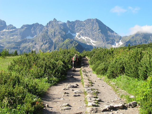
Grzes is a very easy peak accessible from the Dolina Chochołowska. Choose your route in to the Schronisko PTTK na Polanie Chochołowskiej hut using the options mentioned above. From the hut follow the yellow trail up into the woods until eventually you emerge from the dwarf pine onto another very wide, grassy ridge to the top. Views over the Western Tatras from here are superb and this a lovely safe peak to do, even in snowy conditions (only if it is a clear day of course). Fit people can push on from here to Rakon.


Grzes summit

The trail on to Rakon
This area is popular with walkers in summer and ski mountaineers in winter.

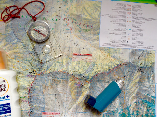
This map is essential
Gęsia Szyja

View from summit of Gęsia Szyja
Gęsia Szyja is reached from Zazadnia. To get here, jump on one of the numerous Morskie Oko minibuses which leave from the front of the railway station in Zakopane. Make sure you ask the driver to let you off at Zazadnia - cost should be about 8zl - pay when you leave the minibus. Pay your National Park fee and follow the blue trail. It leads firstly to Kaplica Matki Boskiej which is a beautiful wooden church/sanctuary. The basement has an ever present urn of mountain tea to help yourself to - you can make a donation in the box. Don't miss looking at the memorials to deceased mountaineers at the back of the sanctuary.
From here, hike up the steps through the woodland to reach Rusinowa Polana. From this meadow you will be really rewarded with a superb view over to High Tatras and the Bielovodska Valley.
From the valley, take a left (green trail) up some steps, that really do feel like they are never going to end, for approximately an hour. Eventually you will reach the rocky formations on the summit of Gęsia Szyja (1490m). If it is a clear day you will once again feast your eyes on wonderful views to the surrounding peaks. Be careful, there is a sheer drop down quite a distance from this top.


View from Rusinowa Polana
From the summit, you have a number of trails you can opt to use to return you to transport back to Zakopone. You could return back down to Rusinowa Polana. Two easy trails go further from here. The blue very easily takes you down to the roadhead at Morskie Oko with continued nice views as you go. Loads of Zakopane minibuses ply from here. Or, the black trail is a lovely walk with great views over the Bielovodska valley which eventually descends down to the red trail with Morskie Oko hordes, ending with the above mentioned minibus terminus. Cost back to Zakopane - around 10zl.
Alternatively, from the summit you can continue walking along a small ridge until it descends and joins a red trail. This will eventually take you all the way back to Toporowa Cyrhla from where you can catch minibuses back to Zakopane. This is a very long trail though, much of it in forest and on pretty uncomfortable cobbled paths. A better option is to follow this red trail as far as Dolina Suchej Wody. Take a right onto the black trail and follow the track down the valley following the wide river. This is a lot more open, comfortable on the feet and ultimately leads you to Breziny where you can flag a bus to take you back to Zakopane.

Really enjoyed your blog and found it really useful as we trekked up Giewont on one day and also followed the blue trail to Czarny Staw Gasienicowy lake on another day.
ReplyDeleteThank you. Bob Morris