HIGH PEAKS
Orla Perć

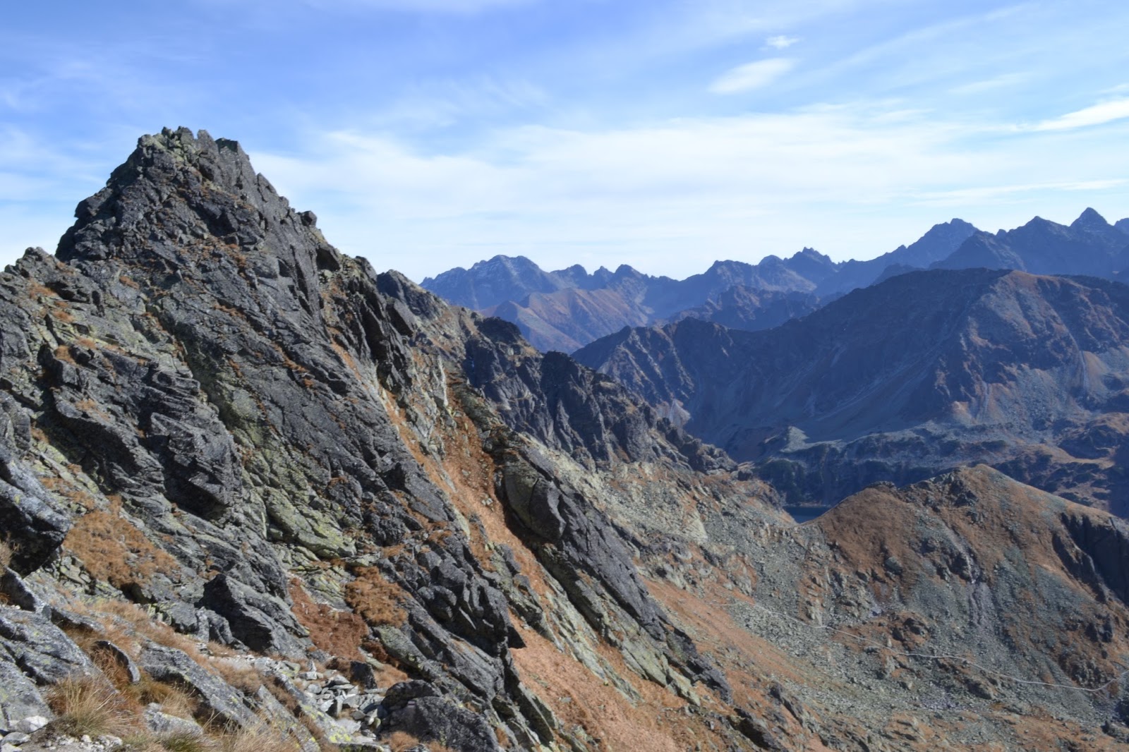
Looking towards Kozie Czuby and Kozi Wierch on Orla Perc
This high mountain ridge in the Polish High Tatras takes
in several peaks and, in English, literally translates as the Eagles Path. This
should straight away give you a clue as to the exposure and views that this
trail affords. It should not be attempted by anyone who does not have
experience in the mountains. It requires a good head for heights and exposure,
good levels of fitness, proper mountain clothing and footwear. In summer, the
various sections of the ridge make for a very exhilarating day up above 2000
metres. The total time for the ridge is around 8 hours, but this does not take
into account the amount of time to walk into it in the first place, and
back out, which would typically add another 4 or more hours onto this. Hence, this
ridge is best tackled, in sections, on different days or visits.


Try to pick up this map at the tourist information office or on Krupówki
Or try zooming in and out on this interactive map below to see the trails and peaks mentioned along the route.
It is badged as a via ferrata, but it distinctly is not.
What it actually consists of is a long exposed, dangerous ridge, to which
various climbing aids have been added such as ladders, chains and metal steps
stapled into cliffs. There has been much debate about how sensible the addition
of these aids are (they were first added in 1911), since it encourages people
with no climbing skills into what would normally be climbing pitches in very
treacherous, exposed locations. As a result, there was even a campaign to have
them removed and leave the ridge to the puritans.
However, it was decided to keep them for historic reasons, but a safety compromise was to have a one way system implemented at the stretch from Zawrat Pass - Kozi Wierch. This was because many accidents
were happening in sections where ridge “tourists” were trying to pass each
other on ladders and chains. In fact, there has been in excess of 120 deaths on
the ridge!


One thing
really is for sure, do not go near here in winter at all because of avalanche risk.
Also, to tackle the ridge in winter conditions is a hard core, proper
experienced mountaineers excursion.
On your map, the scary bits are marked with yellow circles rimmed with red. These are where you will find the chains, ladders, metal steps etc.
Easy Access Stage
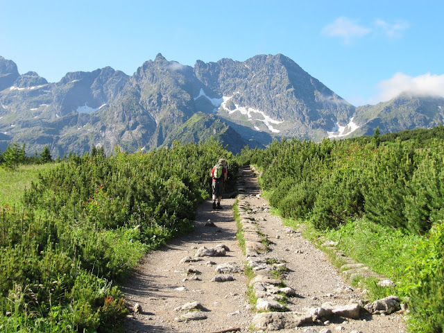
Świnica

Views as you approach Swinica, Orla Perc

Easy trail as you approach Swinica

If you are feeling flush, this is a bit of cheat to start with. Take one of the many minibuses from Zakopane to Kuznice from outside the main bus station. Hop on the cable car and take a left along the easy broad ridge for about an hour and a half to the foot of Świnica (2301metres). From this point it is a sustained climb upwards with a few scrambles, chains and metal steps stapled into vertical slabs.


The Swinica end of the ridge in winter. Swinica is the biggest peak in this view
The last little section has a minor "bad step" which is slightly awkward and exposed, Also, because this route is so accessible from the cable car, it attracts a lot of "ridge tourists" (i.e.people who really should not be there!).
Not so easy access stages!
Świnica to Zawrat

Don't be fooled by how short the distance looks on the map. Despite the benign appearance, it really does take 50 minutes/to an hour. The reason for this is the trail leads along a collection of chains, narrow mini gulleys and slope hugging paths. Nice walking though, and not the most difficult part of the ridge. Eventually you will wind up at Zawrat pass.


Negotiating the chains and steps on Świnica
View from Zawrat, Orla Perc

Ledge like path on the way to Zawrat, Orla Perc
There is an alternative route to this point which, involves tramping up the blue trail signposted for Schronisko PTTK Murowaniec from Kuznice. Presently you will happen upon at very large mountain hut serving meals, beers etc as well as offering accommodation. On arriving at the hut, you are still following the blue trail, but this time it is signposted for Czarny Staw Gąsienicowy.


Czarny Staw Gąsienicowy (Black Tarn Gąsienicowy) - with blue trail skirting its edge on its way upwards to Zawrat
From here, enjoy walking around the crystal clear waters of the lake and after two hours from this point, you will scramble your way up areas of chains and mini rock climbs to Zawrat pass. This route does become awkward if you meet people coming from the opposite direction. Or worse, if winter snow lingers over the route obscuring the trail and the climbing aids! If you have come along the ridge from Świnica described above, you can bail out down this blue route.Zawrat to Mały Kozi Wierch to Kozia Przełęcz

Orla Perć after Zawrat

This is the point where things start to get very serious. Lots of exposure, chains, stapled steps and stamina needed. The maximum height on this stretch is achieved by topping onto Mały Kozi Wierch (meaning Little Kozi Wierch) at 2228 metres.

Enjoying the views from Mały Kozi Wierch to Kozia Przełęcz col, Orla Perć
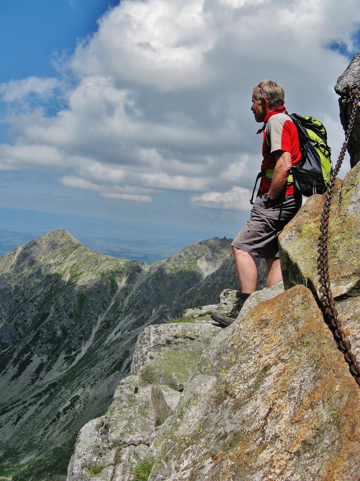
From here eventually you arrive at another ascent/descent path marked in yellow at Kozia Przełęcz col. This is a dramatic col, and the descent down into it is by means of a long, wobbly ladder on an exposed cliff face. Even backing your ass over the top of it to place yourself in a position to climb down takes major inner strength! The col itself often serves as a wind funnel which adds to the fear factor.

Looking towards climbers on the south slabs Kozie Czuby and Kozi Wierch on Orla Perć

Long wobbly ladder descending down to Kozia Przełęcz col, Orla Perć

Proceding downwards into Kozia Przełęcz col from the end of the ladder on Orla Perć
You can bail out down the yellow route should you choose at this point.


Kozia Przełęcz to Kozi Wierch to Żleb Kulczyńskiego

One of the easier stretches!

For me, this next section of the ridge proved to be pretty challenging. Firstly, you have to negotiate slithering around slabs onto the south facing side of Orla Perć, initially, by means of some chains bolted into the rocks. This is exposed and even the lightest of winds whistle menacingly through this slit. The trail then takes a long, steep, exposed and relentless pull upwards onto Kozie Czuby until eventually summitting Kozi Wierch. There is a lot of scrambling involved, but always with good holds and the back up of chains and metal staple style steps.


The fine views of the High Tatras from Orla Perć
The tiny ledge being stood on in this picture is the path!
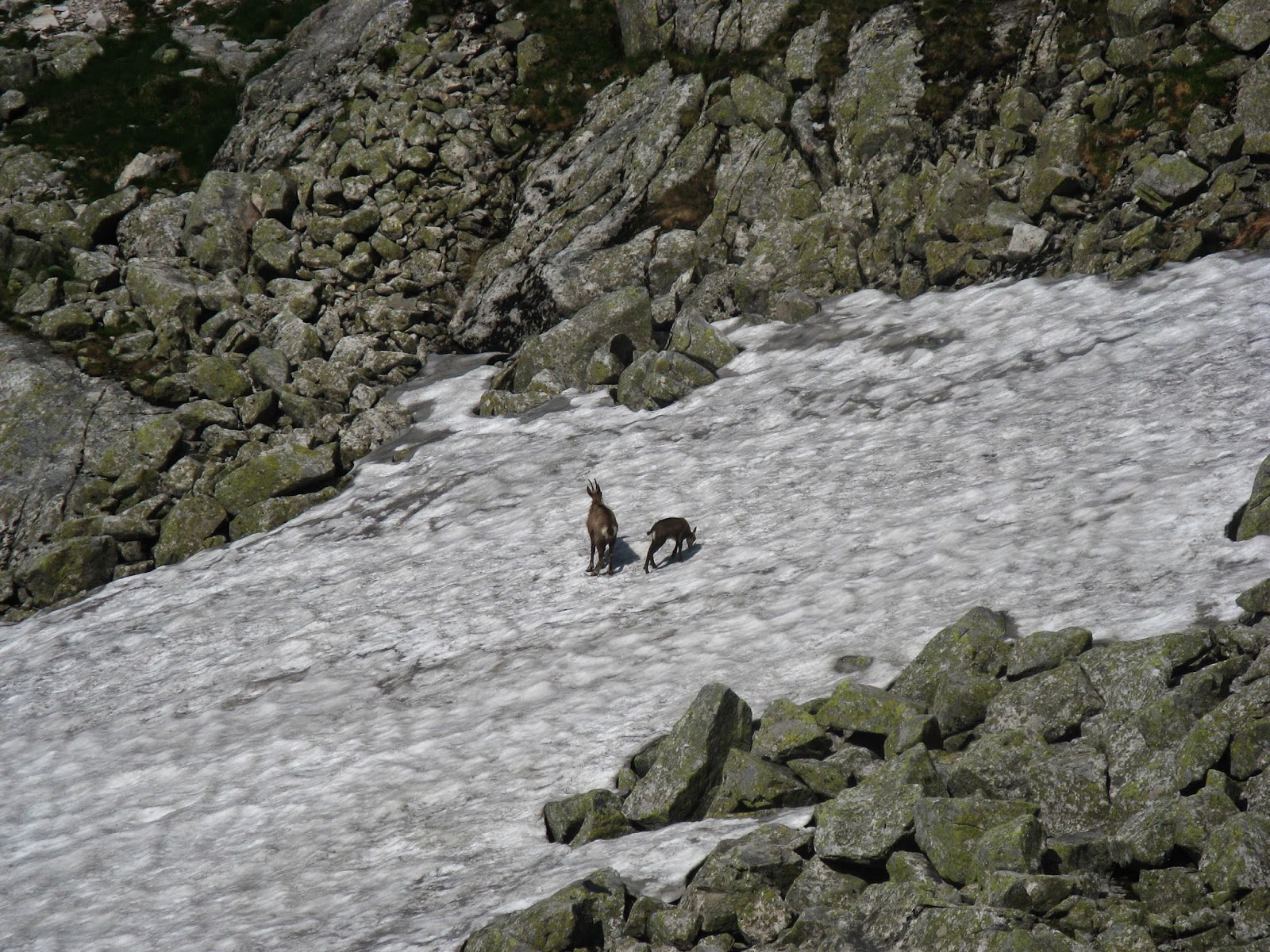
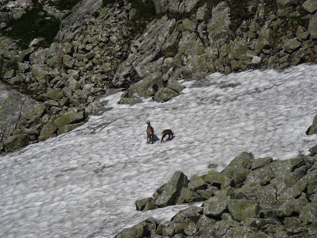
Meet the locals
My experience was tempered by a consistent feeling of terror which tensed my body up meaning I was literally clinging for grim death to everything I could get a grip of. There was even the odd little involuntary bleat or gasp of terror escaping my lips from time to time. Parts of the path were nothing more than what felt like a 30cm ledge. The rest involved scrambling upwards, upwards and upwards again! Believe me, the skull and crossbone symbols along this stretch of ridge on your map are there for extremely good reason!!! Rest assured though, once you get to the top of Kozi Wierch (2291 metres) the worst of it is over.
Descent down the black trail at Żleb Kulczyńskiego
Descend from the peak by continuing to strike eastwards along the ridge until you arrive at a gully named Żleb Kulczyńskiego. The red trail joins a black route here and offers the chance to descend off the ridge. It is very steep though and open to any rocks fellow trail tourists make knock off above you. However, it is perfectly doable, even by slithering down on your bottom which was method of choice. There are chains to assist you should you need them. However, not a great place to be if a summer storm bubbles up. This unfortunately has been my experience. The air was literally sizzling with static electricity and the thunder sounded like it was cracking the rocks in half on the slabs above.

Safely down from the ridge
Granaty

Orla Perć view with Granaty second from the left

The approach to Schronisko PTTK Murowaniec
Granaty is part of Orla Perć. There is no one way system on it so in theory it has two possible access routes. However, due to a serious, tricky chimney climb at Żleb Kulczyńskiego, it is best approached from Czarny Staw Gąsienicowy. This massif actually consists of three peaks and is the easiest section of Orla Perć.

To access it involves tramping up the blue trail signposted for Schronisko PTTK Murowaniec from Kuznice. From Murowaniec mountain hut keep following the blue trail, but this time it is signposted for Czarny Staw Gąsienicowy. Once at the lake, follow the shoreline to your left for around 800 metres.
 Czarny Staw Gąsienicowy
 Presently you will arrive at markers for a yellow trail which gains height quickly as it crosses diagonally over a scree filled gully. Once this is crossed, proceed up the path to the right of the gully onto the western rib of Skrajny Granat. The path then zig-zags upwards to the summit with some areas secured with chains for extra security.


For those seeking more technical, challenging climbing, you might be interested in the following link which details a number of routes on Granaty.
http://www.summitpost.org/granaty/343117
 Czarny Staw Gąsienicowy
Granaty from Czarny Staw Gąsienicowy in spring

The yellow trail zig-zags up the final stretch to Skrajny Granat
From the summit of Skrajny Granat (2225 metres), follow the ridge in a southerly direction, crossing Pośredni Granat (2234 metres) to access the highest point at Zadni Granat (2240 metres).
Pośredni Granat and Zadni Granat as seen from the yellow trail
There is a slightly awkward bit which involves stepping across an open gap between rocks, but there is a chain to grip on to. If you choose to continue to follow the ridge from here, there are two descent options. The first and easiest is the green trail down the south west slope. The second is more challenging. It involves continuing on the ridge until you meet a very abrupt descent in the form of a long chimney. This does present difficulty as one has to reverse down it backwards hanging onto chains and making use of metal, stapled steps into the rock. Although exhilarating, it is not for the faint hearted!
Chimney down to Żleb Kulczyńskiego
From the base of the chimney, you proceed down the black trail at Żleb Kulczyńskiego which via a green leading onto yellow trail, eventually connects you back on the blue trail back to Czarny Staw Gąsienicowy.For those seeking more technical, challenging climbing, you might be interested in the following link which details a number of routes on Granaty.
http://www.summitpost.org/granaty/343117
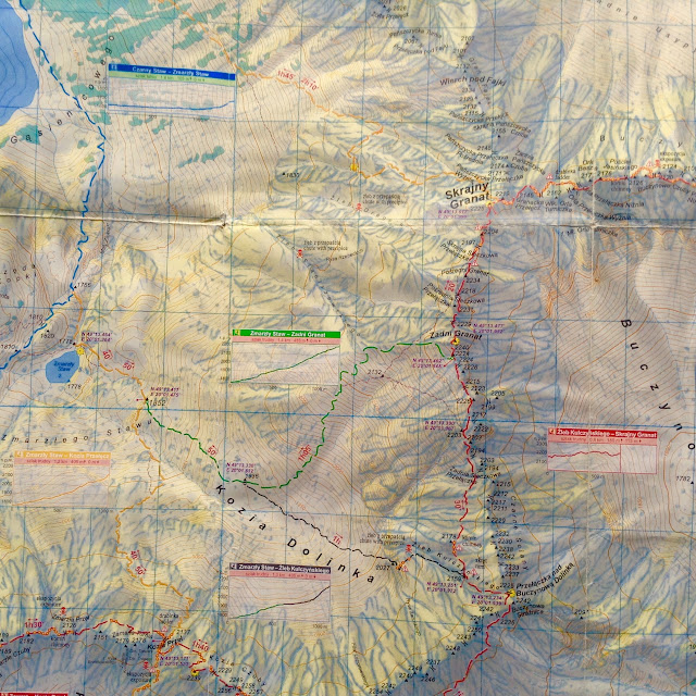
Skrajny Granat to Krzyżne
This final dramatic stretch of Orla Perc can also be reached from ascending Granaty.

Essential map for this stretch of Orla Perc
On summiting, this time follow the trail to the east. This immediately presents challenge as there is an initial awkward exposed step around a small rock buttress. The trail descends steeply from here and presently you will reach a series of chains helping you to descend a narrow gash in the rock. Continue along the ridge from the base of here on the north side. Presently you will reach reach Granacka Przełęcz.

Contemplating the looming obstacle ahead!
 Look really closely and you will see where the trail leads. Notice the ladder just left of centre


Looking down onto the Buczynowa Dolina (Beech Valley)

Yet another challenge awaits!

Admiring the view to the Dolina Roztoki (Five Polish Ponds)
The trail then traverses around Orle Turniczk to reach a long ladder and set of chains. This allows the ascent towards the Niżnia Orla Przełączka. Next is a traverse of the edge of the Orla Baszta (Eagle Tower). At the end of this is a narrow, scary chimney descended with the aid of chains. The next stage involves contouring across Buczynowe Czuby. This really is not for the faint hearted as here are some north facing exposed steep slabs with an extremely narrow foot width ledge running horizontally across. The route involves slotting the right side of you feet into it, whilst clinging onto a series of loose hanging chains bolted to the slabs. This is exposed, tricky and not the best experience for vertigo sufferers.

Views across to the High Tatras
The trail then switches to face south and presents little difficulty until Buczynowa Turnia. Ahead is a narrow loose path over the stones and rocky formations. This leads to a massive cliff edge with steep gully beyond. This is a difficult descent with chains once again to help. From this, the terror is not over as the next obstacle is a relatively tricky climb leading up a gully to Buczynowa Przełęcz (Beech Pass). Use the chains here to haul yourself up (expect aching arms the next day from this) but the good news is this is the last tricky section of the ridge. The last section is broad, grassy and offers superb views to over the Dolina Roztoki on your right to the High Tatras beyond.

Getting that "airy" feeling on Orla Perc

Views over the Five Polish Ponds

Looking back at the ridge we have just conquered

The final easy stretch
However, don't relax too much because if you are planning on returning to Murowaniec Schronisko hut and eventually back to Kuznice, as it is a long walk out taking almost two and a half hours just back to the hut itself. That's why it is crucial to bring plenty of water. In summer, also check the forecast carefully as you will be very exposed to a potential thunderstorms for a long time along this route.

The walk out is long - but pleasant. Look out for marmots

An alternative descent would be to follow the yellow trail down into the Dolina Roztoki which then connects to the green trail which ultimately joins the red route used by Morskie Oko trekkers. You will wind up at the car park where many minibuses await to take you back to Zakopane.
MORE TO COME!

Comments
Post a Comment